Hiking in Burren National Park- An Unexpected Landscape in Ireland
Purchases made through links earn us a small commission, at no extra cost to you.
Standing at the trailhead into Burren National Park, fascination sets in as I gaze off into the remote, rocky landscape.
This is not what I expected to see in Ireland.
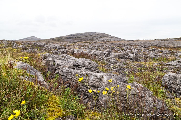
The land here is harsh, grey. The Burren most certainly is not the rolling green fields I’d come to associate with Ireland.
Instead, I find myself surrounded by a karst landscape for the first time during my road trip in Ireland.
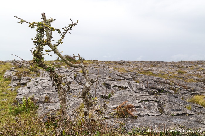
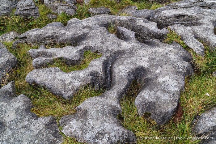
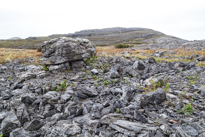
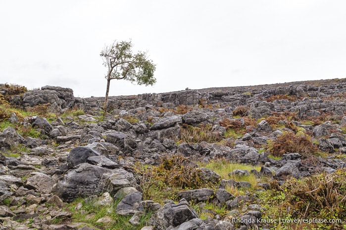
Fields of limestone stretch as far as I can see, covering what used to be an ancient seabed. Heaps of loose boulders are scattered across stepping-stones of smooth pavement, eroded and polished from years of glaciation. Patches of grass, wildflowers, and short bushes are growing between the rocks, creating pockets of colour in an otherwise drab day.
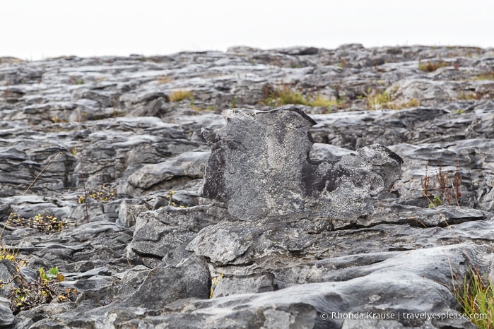
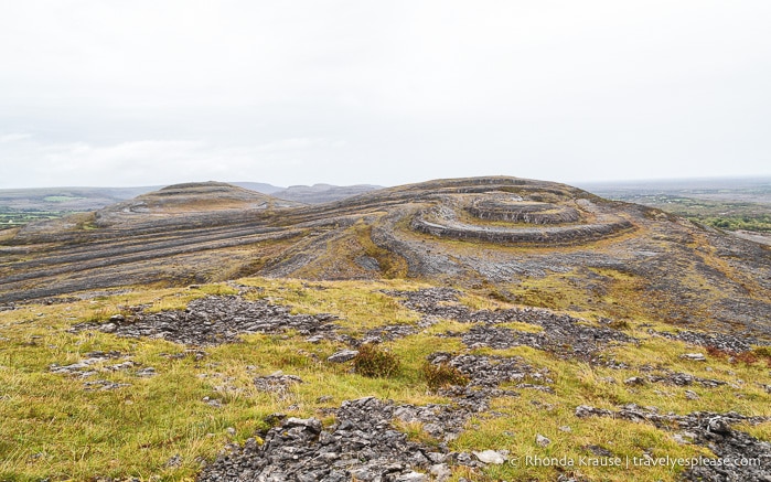
Off in the distance I see a hill that looks as though it has been wrung like a wet towel, distinct layers of rock twisting around its curved surface.
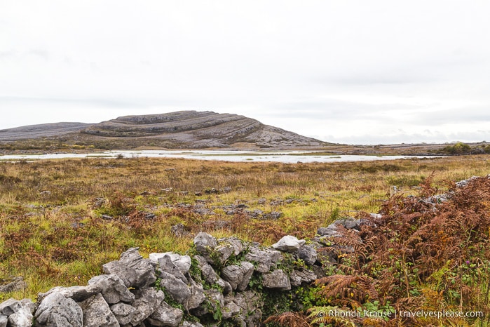
Impressed by this surprising landscape, an excited energy takes over as I step off the road and into the rugged countryside, embarking on a rainy day hike in the Burren.
Hiking in Burren National Park
My mission for the day was to complete the 7.5 km Mullaghmore Loop (the blue route on the trail map). This route would take me past Lough Gealain, up to the summit of Mullaghmore hill, down the other side, then circle halfway around the base of the hill before linking up near the midway point of the trail.
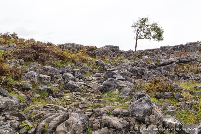
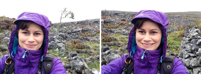
The Mullaghmore Loop trail was rated very difficult, the constant rain and wind an added challenge. Everyone who started the hike the same time as I did either turned back or chose a different route, leaving me all alone in this rocky frontier.
To start the hike there was a somewhat defined path to follow, but it wasn’t a typical dirt hiking trail. Soon the path largely disappeared into a sea of rocks, leaving only pieces of slippery limestone to walk on.
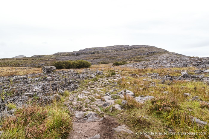
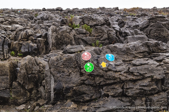
I made sure to pay attention to my surroundings, keeping a keen eye out for the little colourful trail markers, often screwed onto boulders, indicating the way. I wasn’t worried about getting lost since the wide-open space made it easy to see the general direction I came from, but I didn’t want to get off course either, especially since I was hiking alone in the rain.
Traversing across the smooth, unevenly shaped rocks, I had to be careful where I stepped. Not only was the surface incredibly slick, but the mud that separated the stones would really make my shoes slippery if I slid into it.
The closer I got to Mullaghmore hill, the rockier the landscape became. There were even a few points where I had to use my hands to climb up over the stone.
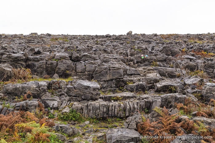
Once I got higher up on Mullaghmore, I realized it probably wasn’t a good idea to be out there alone. If I slipped and fell it would be easy to break a hip, leg, or even get a concussion.
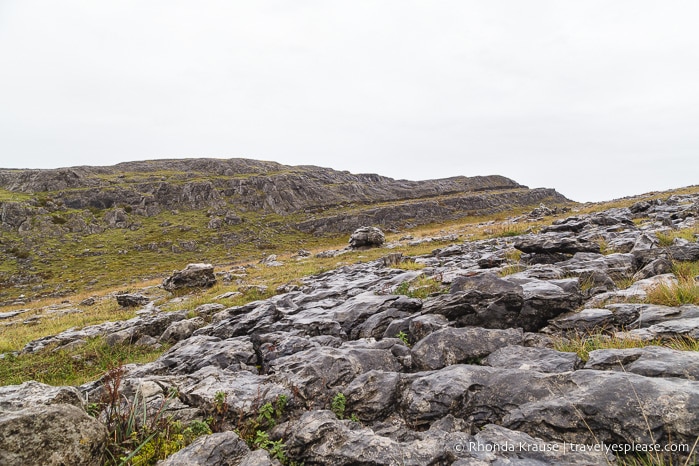
Second-guessing my plan, I looked back to the direction I came from and saw a couple coming my way. As much as I like having places all to myself, I was a little relieved that I wasn’t alone out there anymore. They eventually passed me but never got out of view, making sure to look back now and then to check that I was doing okay.
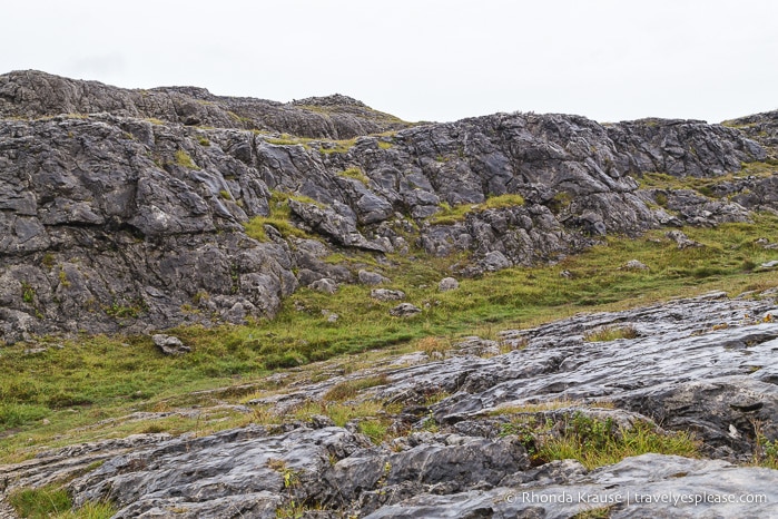
Continuing on, I finally reached the summit of Mullaghmore and the end of the green route. The view was fantastic! Staring across the Burren, I got a better idea of just how much rock I crossed over to get to this point.
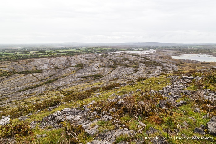
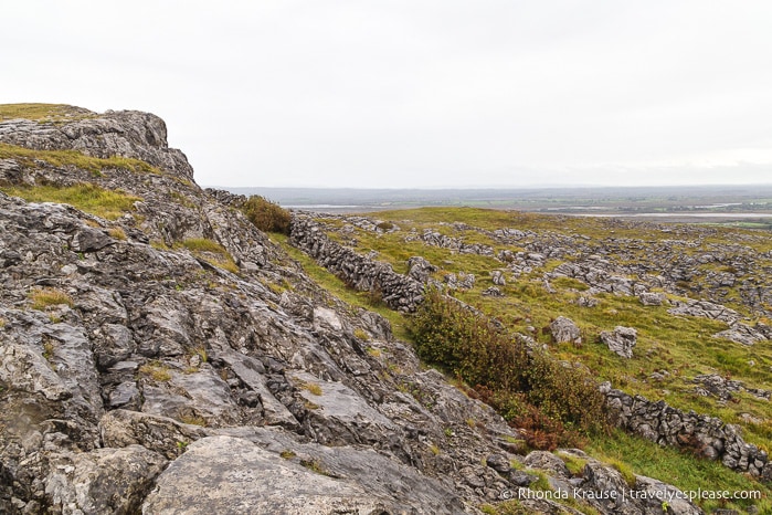
As wind and rain whipped around me, I thought of turning back. Ultimately, my curiosity won out and I decided to finish the blue route as planned.
I was so glad I decided to press on because the scenery kept getting better the further I walked. It wasn’t long after the green route ended that I came to the best view of the hike.
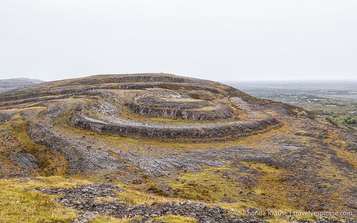
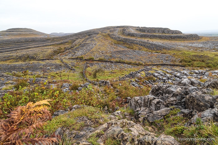
In front of me was a rounded, terraced hill unlike anything I’d seen. Its twisted, swirling shape was so intriguing, I couldn’t help but stare and wonder how it was formed. This instantly became my favourite place in Burren National Park.
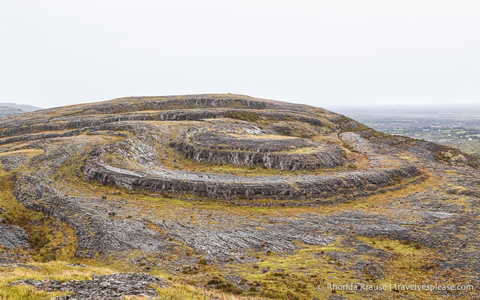
After an extended time admiring the view, I began the descent down the back of Mullaghmore hill. It was quite steep and I had to really concentrate, carefully choosing where to step.
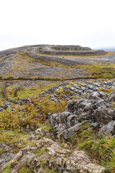
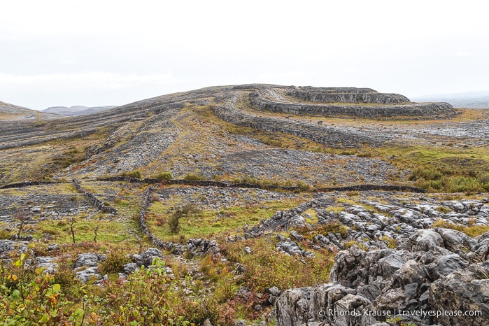
Even so, I had a few big slips but was able to save myself from falling. I jammed my hip a bit, but it was definitely better than cracking my head open!
At the bottom of the hill, I looked up at where I just came from.
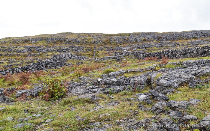
This could have went so wrong in so many ways, I thought, reminding myself how risky it was to be hiking this terrain by myself, especially in the rain.
It wasn’t easy-going just yet, as the rock-strewn trail around the base of the hill was still slippery and also partially concealed by grass. I felt like I was on a scavenger hunt looking for those small blue trail markers!
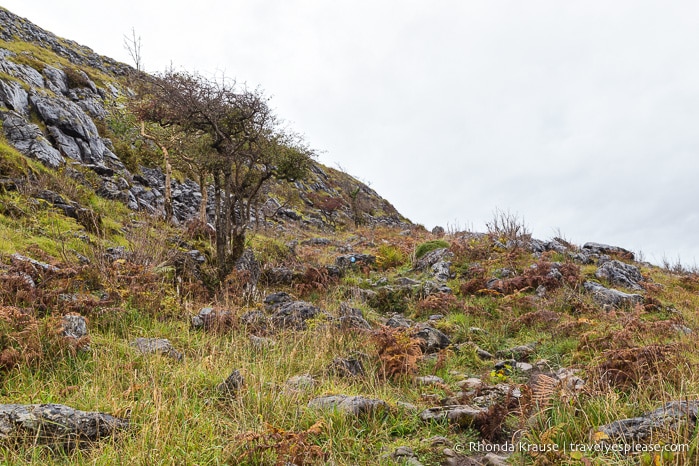
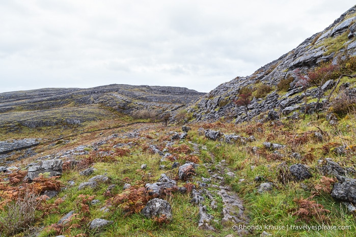
Once I got past the hill and into a more open area, I started to notice some interesting patterns in the rocks. On closer inspection, I could tell they were fossils of coral and other sea plants, a reminder of what this area was like millions of years ago.
Having now completed the loop around Mullaghmore hill, I headed back towards the trailhead. It was a little disorienting because there were so many rocks- everything looked the same! I had to scan the landscape for the small signs I followed on the way in because there weren’t any directing the way out.
Returning to my car wet, windblown, and muddy, I felt a wave of satisfaction. It’s hard to explain just how much I loved hiking in Burren National Park. I overcame some doubt, persevered through challenges, and was surprised by some unexpected scenery on the other side of Mullaghmore hill.
What I appreciated most though was the beautiful loneliness of the landscape. The Burren is pure and simple. It’s a place that encourages reflection, generating a connection between nature, self, and a time long since past.
Hiking in the Burren, I was reminded of how forces of nature can change landscapes drastically, but if they are protected from human interference, these special places will still exude a powerful sense of what they once were.
Tips for Hiking in Burren National Park
Location: Burren National Park is located in the south-eastern area of the Burren, in north County Clare.
Burren National Park Information Point: The park’s information centre is in the village of Corofin, at the Clare Heritage Centre. It’s open year round (see current hours here). I stopped at the information centre before my hike to get a map and directions to the trailhead. The centre also provides a free shuttle bus to the park (the trailhead at Gortlecka Cross, near Kilnaboy) from May to September.
Trailhead and Parking: From Corofin, take R476 to Kilnaboy. In Kilnaboy, turn right just before the church ruins onto L1112. Continue for about 5 km until you reach a lay-by (just before the crossroads) where you can park. It’s very small so there’s not room for many cars. From here you can walk along the “crag road” to the National Park land.
- While you can turn right at the crossroads and drive along the crag road to get closer to what I would consider the real trailhead, it’s not recommended to park here because it can damage vegetation on the roadside.
What to Bring: Wear strong hiking shoes with good grips and ankle support. Hiking poles would have come in handy in a few places. Dress in layers and bring rain gear because the weather can change fast. I also had a whistle-compass combination attached to my backpack and made note of the emergency phone number, just in case.
Walking Trails in Burren National Park: There are 3 way-marked routes that go to the summit of Mullaghmore hill (all rated very difficult), and two shorter, easier routes that stay near the parking lot. Here is a trail map of walks in Burren National Park.
- Mullaghmore Return (Green Route): The green route is 6.5 km and goes to the summit of Mullaghmore hill and back. It ends before what I thought was the best view (the “twisted” hill). Estimated hiking time is 1 hr 45 mins.
- Mullaghmore Loop (Blue Route): This is the route I did. It’s 7.5 km with an ascent of 140m. Estimated hiking time is 2 hrs 55 mins.
- Mullaghmore Traverse (Red Route): The red route is a 6 km non-looped walk traversing the summit of Mullaghmore and ending at Coolorta. Estimated hiking time is 3 hrs.
- Nature Trail (White Arrow Route): The white arrow route is a 1.5 km loop. It climbs 20 m and is rated moderate. It passes through ash and hazel woodland, hay meadows, and areas of limestone pavement. Estimated walking time is 40 min.
- Knockaunroe Turlough (Orange Route): The orange route is a 1.3 km loop. It climbs 20 m and is rated moderate. It also passes through woodland and a hay meadow. Estimated walking time is 30 min.
Guided Walks: The National Parks and Wildlife Service offers free guided walks in Burren National Park (not in off-season) focusing on the flora, fauna and geology. Reservations are required and spaces are limited. Contact the park office for more information.
Other Places of Interest in the Burren: If you have time after hiking in the Burren, I recommend you go see Poulnabrone dolmen, one of the best preserved portal tombs in Ireland.
Information was updated January 2025, but can change without notice. Please confirm directly with service providers.
Where to Stay- Accommodations in the Burren
I based myself in Doolin, as it was not too far from the heart of the Burren and starting point for the Cliffs of Moher Coastal Walk, which I planned to do the next morning. Other towns that would be convenient for exploring the Burren are Corofin, Kilfenora, Lisdoonvarna, Ballyvaughan, and Ennistymon.
For your convenience, here is a list of hotels in Doolin, Lisdoonvarna, Ballyvaughan, and Ennistymon, as these have the largest selection of accommodations. Please consider booking your Burren accommodations through the included links. It costs nothing extra and helps support this website. Thank you!
More Ireland Destinations and Travel Guides
- The Gap of Dunloe- Boat and Bike Trip from Killarney
- Day Trip to Inishmore- The Largest of Ireland’s Aran Islands
- Driving the Dingle Peninsula- Points of Interest
- Driving the Ring of Kerry- Points of Interest and Scenic Detours
